 vesseltracker.com
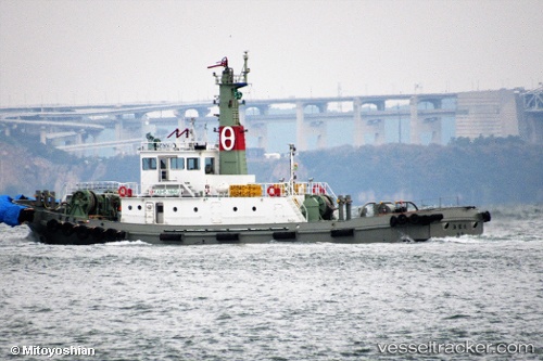
Kaiho Maru
Current StatusWhere is the vessel?
Kaiho Maru is currently in Near MIZUSHIMA, based on AIS data received about 2h ago.
Latest AIS update:
Current position: 34.48635° N, 133.74129° E (Near MIZUSHIMA)
Average speed (last 7 days): Loading…
Average speed (last 30 days): Loading…
Vessel profile: Kaiho Maru is a Tug with dimensions 9m x 37m.
This page combines live AIS, route history, probable destination signals, nearby traffic, and port activity for practical vessel monitoring.
The current position of vessel Kaiho Maru is 34.48635 lat / 133.74129 lng. Updated: 2026-04-24 13:43:21 UTCNearest reference points:
- Near MIZUSHIMA
- Near Kurashiki
- Near Sakaide
Details:
Live Vessel Kaiho Maru Analytics (details, animations, etc.)
Recent AIS points (UTC):
2026-04-24 10:50:39 UTC · 34.45792, 133.76236 · SOG 9.4 kn · COG 145°2026-04-24 12:21:36 UTC · 34.43791, 133.76958 · SOG 11.1 kn · COG 317°
2026-04-24 13:01:41 UTC · 34.47402, 133.74980 · SOG 5.3 kn · COG 341°
2026-04-24 13:43:21 UTC · 34.48635, 133.74129 · SOG 1.3 kn · COG 254°