 vesseltracker.com
 BUNKER
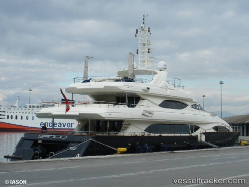
Current Status
Where is the vessel?
BUNKER is currently in Near AGIOS KOSMAS, based on AIS data received less than 1h ago.
Latest AIS update:
Current position: 37.87803° N, 23.72590° E (Near AGIOS KOSMAS)
Average speed (last 7 days): Loading…
Average speed (last 30 days): Loading…
Vessel profile: BUNKER is a Yacht with dimensions m x m.
This page combines live AIS, route history, probable destination signals, nearby traffic, and port activity for practical vessel monitoring.
The current position of vessel BUNKER is 37.87803 lat / 23.72590 lng. Updated: 2026-04-30 01:58:47 UTCNearest reference points:
- Near ALIMOS
- Near FLISVOS
- Near ZEA
Currently sailing under the flag of Malta ![]()
Details:
Live Vessel BUNKER Analytics (details, animations, etc.)
Recent AIS points (UTC):
2026-04-29 23:07:45 UTC · 37.87801, 23.72592 · SOG 0 kn · COG -1°2026-04-30 00:14:42 UTC · 37.87803, 23.72591 · SOG 0 kn · COG -1°
2026-04-30 01:32:45 UTC · 37.87804, 23.72592 · SOG 0 kn · COG -1°
2026-04-30 01:58:47 UTC · 37.87803, 23.72590 · SOG 0 kn · COG -1°