 vesseltracker.com
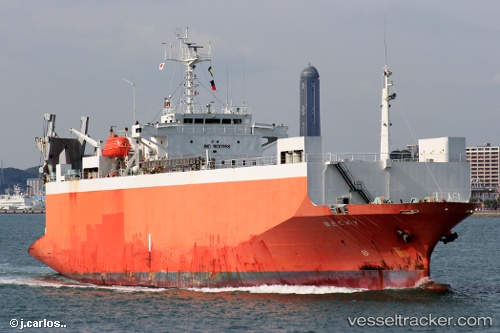
 HARMONI MAS 8
Current Status
Where is the vessel?
HARMONI MAS 8 is currently in Near New Priok Port, based on AIS data received less than 1h ago.
Latest AIS update:
Current position: 6.05595° S, 106.89892° E (Near New Priok Port)
Average speed (last 7 days): Loading…
Average speed (last 30 days): Loading…
Vessel profile: HARMONI MAS 8 is a Ro-Ro Cargo Ship with dimensions 20m x 97m.
This page combines live AIS, route history, probable destination signals, nearby traffic, and port activity for practical vessel monitoring.
The current position of vessel HARMONI MAS 8 is -6.05595 lat / 106.89892 lng. Updated: 2026-05-13 19:21:03 UTCNearest reference points:
- Near New Priok Port
- Near Jakarta
- Near Ancol
Currently sailing under the flag of Indonesia ![]()
HARMONI MAS 8 built in 1994 year
Deadweight:
3751 tDetails:
Live Vessel HARMONI MAS 8 Analytics (details, animations, etc.)
Recent AIS points (UTC):
2026-05-13 16:02:46 UTC · -6.05629, 106.89910 · SOG 0 kn · COG -1°2026-05-13 16:08:47 UTC · -6.05624, 106.89908 · SOG 0 kn · COG -1°
2026-05-13 17:35:30 UTC · -6.05598, 106.89890 · SOG 0 kn · COG -1°
2026-05-13 19:21:03 UTC · -6.05595, 106.89892 · SOG 0 kn · COG -1°