 vesseltracker.com
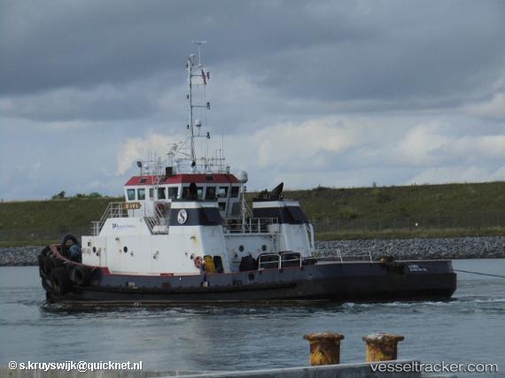
 Hawk
Hawk
Current Status
Where is the vessel?
Hawk is currently in Near Miami River, based on AIS data received less than 1h ago.
Latest AIS update:
Current position: 25.77376° N, 80.17700° W (Near Miami River)
Average speed (last 7 days): Loading…
Average speed (last 30 days): Loading…
Vessel profile: Hawk is a Tug with dimensions 33m x 12m.
This page combines live AIS, route history, probable destination signals, nearby traffic, and port activity for practical vessel monitoring.
The current position of vessel Hawk is 25.77376 lat / -80.17700 lng. Updated: 2026-05-14 11:27:34 UTCNearest reference points:
- Near Miami River
- Near Miami
- Near Miami Beach
Currently sailing under the flag of USA ![]()
Hawk built in 1995 year
Deadweight:
75 tDetails:
Live Vessel Hawk Analytics (details, animations, etc.)
Recent AIS points (UTC):
2026-05-14 08:01:47 UTC · 25.77372, -80.17698 · SOG 0.1 kn · COG 112°2026-05-14 10:23:56 UTC · 25.77372, -80.17696 · SOG 0.1 kn · COG 113°
2026-05-14 10:32:05 UTC · 25.77373, -80.17698 · SOG 0.1 kn · COG 112°
2026-05-14 11:27:34 UTC · 25.77376, -80.17700 · SOG 0 kn · COG 112°