 vesseltracker.com
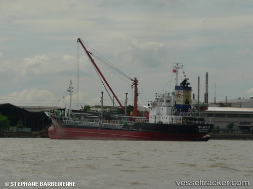
 BIG SEA 17
Current Status
Where is the vessel?
BIG SEA 17 is currently in Near RAYONG, based on AIS data received about 1h ago.
Latest AIS update:
Current position: 12.63948° N, 101.30469° E (Near RAYONG)
Average speed (last 7 days): Loading…
Average speed (last 30 days): Loading…
Vessel profile: BIG SEA 17 is a Oil Products Tanker with dimensions m x m.
This page combines live AIS, route history, probable destination signals, nearby traffic, and port activity for practical vessel monitoring.
The current position of vessel BIG SEA 17 is 12.63948 lat / 101.30469 lng. Updated: 2026-05-14 20:10:51 UTCNearest reference points:
- 11 nm S of Map Ta Phut
- Near SATTAHIP
- Near Tips Container Terminal
Currently sailing under the flag of Thailand ![]()
Details:
Live Vessel BIG SEA 17 Analytics (details, animations, etc.)
Recent AIS points (UTC):
2026-05-14 17:00:34 UTC · 12.59680, 101.23383 · SOG 10.7 kn · COG 66°2026-05-14 18:15:03 UTC · 12.60994, 101.25776 · SOG 11.4 kn · COG 59°
2026-05-14 19:16:44 UTC · 12.63947, 101.30471 · SOG 0 kn · COG 207°
2026-05-14 20:10:51 UTC · 12.63948, 101.30469 · SOG 0.1 kn · COG 207°