 vesseltracker.com
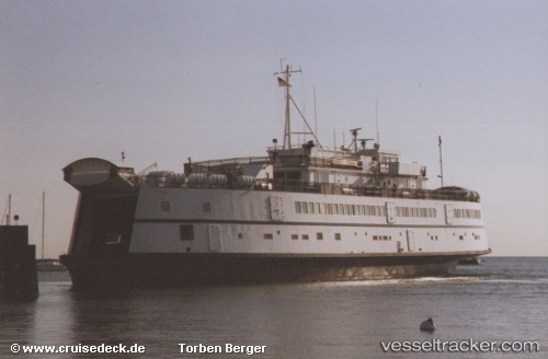
Marthas Vineyard
Current StatusWhere is the vessel?
Marthas Vineyard is currently in Near FAIRHAVEN, based on AIS data received less than 1h ago.
Latest AIS update:
Current position: 41.63334° N, 70.90647° W (Near FAIRHAVEN)
Average speed (last 7 days): Loading…
Average speed (last 30 days): Loading…
Vessel profile: Marthas Vineyard is a Passenger Ro Ro Cargo Ship with dimensions 18m x 68m.
This page combines live AIS, route history, probable destination signals, nearby traffic, and port activity for practical vessel monitoring.
The current position of vessel Marthas Vineyard is 41.63334 lat / -70.90647 lng. Updated: 2026-05-14 18:07:05 UTCNearest reference points:
- Near FAIRHAVEN
- Near NEW BEDFORD
- Near VINEYARD HAVEN
Details:
Live Vessel Marthas Vineyard Analytics (details, animations, etc.)
Recent AIS points (UTC):
2026-05-14 14:14:29 UTC · 41.46033, -70.55448 · SOG 5.5 kn · COG 158°2026-05-14 16:21:51 UTC · 41.52223, -70.67080 · SOG 0 kn · COG 85°
2026-05-14 16:51:24 UTC · 41.52220, -70.67290 · SOG 1.8 kn · COG 170°
2026-05-14 18:07:05 UTC · 41.63334, -70.90647 · SOG 0 kn · COG 82°