 vesseltracker.com
 Med Denizli
Current Status
Where is the vessel?
Med Denizli is currently in Near Isdemir, based on AIS data received about 1d ago.
Latest AIS update:
Current position: 36.68480° N, 36.19761° E (Near Isdemir)
Average speed (last 7 days): Loading…
Average speed (last 30 days): Loading…
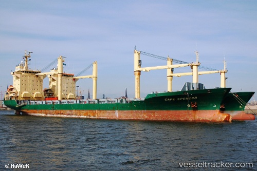
Vessel profile: Med Denizli is a Container Ship with dimensions 152m x 24m.
This page combines live AIS, route history, probable destination signals, nearby traffic, and port activity for practical vessel monitoring.
The current position of vessel Med Denizli is 36.68480 lat / 36.19761 lng. Updated: 2026-04-10 07:39:26 UTCNearest reference points:
- Near Iskenderun
- Near DORTYOL
- 13 nm W of Iskenderun
Currently sailing under the flag of Turkey ![]()
Med Denizli built in 1996 year
Deadweight:
13623 tDetails:
Live Vessel Med Denizli Analytics (details, animations, etc.)
Recent AIS points (UTC):
2026-04-10 02:15:28 UTC · 36.68480, 36.19761 · SOG 0 kn · COG -1°2026-04-10 04:00:28 UTC · 36.68477, 36.19761 · SOG 0 kn · COG -1°
2026-04-10 05:36:30 UTC · 36.68478, 36.19764 · SOG 0 kn · COG -1°
2026-04-10 07:39:26 UTC · 36.68480, 36.19761 · SOG 0 kn · COG -1°