 vesseltracker.com
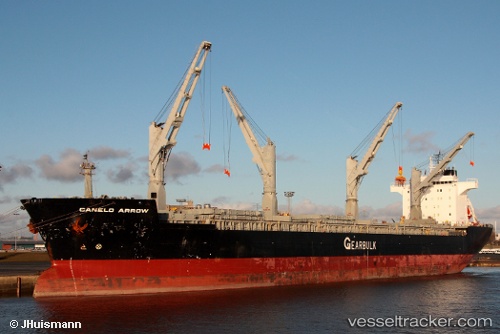
 Canelo Arrow
Current Status
Where is the vessel?
Canelo Arrow is currently in 19 nm SW of Yucatan Channel, based on AIS data received about 3h ago.
Latest AIS update:
Current position: 21.59690° N, 85.26971° W (19 nm SW of Yucatan Channel)
Average speed (last 7 days): Loading…
Average speed (last 30 days): Loading…
Vessel profile: Canelo Arrow is a Multi Purpose Carrier with dimensions 189m x 31m.
This page combines live AIS, route history, probable destination signals, nearby traffic, and port activity for practical vessel monitoring.
The current position of vessel Canelo Arrow is 21.59690 lat / -85.26971 lng. Updated: 2026-05-12 19:59:58 UTCNearest reference points:
- 58 nm S of San Julian
- Near Puerto Juárez
Currently sailing under the flag of Bahamas ![]()
Canelo Arrow built in 1997 year
Deadweight:
48077 tDetails:
Live Vessel Canelo Arrow Analytics (details, animations, etc.)
Recent AIS points (UTC):
2026-05-12 14:39:33 UTC · 20.94539, -84.33162 · SOG 12.1 kn · COG 305°2026-05-12 14:39:33 UTC · 20.94539, -84.33162 · SOG 12.1 kn · COG 305°
2026-05-12 19:59:58 UTC · 21.59690, -85.26971 · SOG 12.4 kn · COG 309°
2026-05-12 19:59:58 UTC · 21.59690, -85.26971 · SOG 12.4 kn · COG 309°