 vesseltracker.com
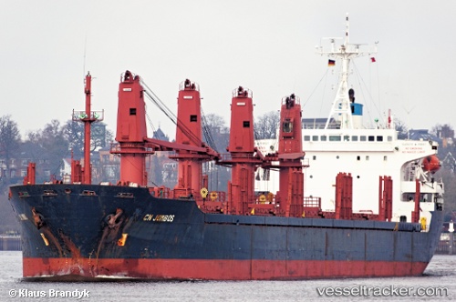
 New Levant
Current Status
Where is the vessel?
New Levant is currently in 18 nm SE of Sulina (Port et Zone Franche), based on AIS data received less than 1h ago.
Latest AIS update:
Current position: 44.99151° N, 30.01406° E (18 nm SE of Sulina (Port et Zone Franche))
Average speed (last 7 days): Loading…
Average speed (last 30 days): Loading…
Vessel profile: New Levant is a Bulk Carrier with dimensions 165m x 43m.
This page combines live AIS, route history, probable destination signals, nearby traffic, and port activity for practical vessel monitoring.
The current position of vessel New Levant is 44.99151 lat / 30.01406 lng. Updated: 2026-05-13 19:13:12 UTCNearest reference points:
- 13 nm E of Sulina (Port et Zone Franche)
- 12 nm SE of Sulina (Port et Zone Franche)
- Near Ust-Dunaisk/Vylkove
Currently sailing under the flag of Belize ![]()
New Levant built in 1995 year
Deadweight:
27321 tDetails:
Live Vessel New Levant Analytics (details, animations, etc.)
Recent AIS points (UTC):
2026-05-13 16:22:13 UTC · 44.99454, 30.01372 · SOG 0 kn · COG 224°2026-05-13 17:10:11 UTC · 44.99216, 30.01459 · SOG 0.2 kn · COG 285°
2026-05-13 18:19:11 UTC · 44.99179, 30.01439 · SOG 0 kn · COG 287°
2026-05-13 19:13:12 UTC · 44.99151, 30.01406 · SOG 0.5 kn · COG 290°