 vesseltracker.com
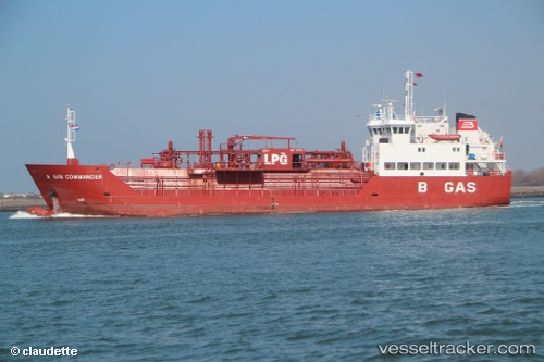
 B Gas Commander
Current Status
Where is the vessel?
B Gas Commander is currently in Near Nansha, based on AIS data received about 2h ago.
Latest AIS update:
Current position: 22.66830° N, 113.67239° E (Near Nansha)
Average speed (last 7 days): Loading…
Average speed (last 30 days): Loading…
Vessel profile: B Gas Commander is a Lpg Tanker with dimensions 74m x 74m.
This page combines live AIS, route history, probable destination signals, nearby traffic, and port activity for practical vessel monitoring.
The current position of vessel B Gas Commander is 22.66830 lat / 113.67239 lng. Updated: 2026-05-15 19:31:44 UTCNearest reference points:
- Near Nansha
- Near Fuyong
- Near Nansha Pt
Currently sailing under the flag of Malta ![]()
B Gas Commander built in 1996 year
Deadweight:
2335 tDetails:
Live Vessel B Gas Commander Analytics (details, animations, etc.)
Recent AIS points (UTC):
2026-05-15 16:58:45 UTC · 22.66830, 113.67239 · SOG 0 kn · COG 332°2026-05-15 17:37:44 UTC · 22.66832, 113.67239 · SOG 0 kn · COG 332°
2026-05-15 19:01:48 UTC · 22.66830, 113.67240 · SOG 0 kn · COG 332°
2026-05-15 19:31:44 UTC · 22.66830, 113.67239 · SOG 0 kn · COG 332°