 vesseltracker.com
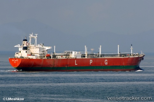
 DA LI
DA LI
Current Status
Where is the vessel?
DA LI is currently in 270 nm W of Bolinao, based on AIS data received about 2h ago.
Latest AIS update:
Current position: 15.63043° N, 115.26993° E (270 nm W of Bolinao)
Average speed (last 7 days): Loading…
Average speed (last 30 days): Loading…
Vessel profile: DA LI is a Lpg Tanker with dimensions m x m.
This page combines live AIS, route history, probable destination signals, nearby traffic, and port activity for practical vessel monitoring.
The current position of vessel DA LI is 15.63043 lat / 115.26993 lng. Updated: 2026-05-14 04:02:43 UTCNearest reference points:
- 222 nm W of Iba
- 282 nm E of Tan Cang Qui Nhon
- 215 nm NE of Tan Cang Qui Nhon
Currently sailing under the flag of Aruba ![]()
Details:
Live Vessel DA LI Analytics (details, animations, etc.)
Recent AIS points (UTC):
2026-05-14 01:30:33 UTC · 15.65287, 115.28636 · SOG 0.7 kn · COG 254°2026-05-14 03:38:23 UTC · 15.63386, 115.27265 · SOG 0.5 kn · COG 241°
2026-05-14 04:02:43 UTC · 15.63043, 115.26993 · SOG 0.6 kn · COG 246°
2026-05-14 04:02:43 UTC · 15.63043, 115.26993 · SOG 0.6 kn · COG 246°