 vesseltracker.com
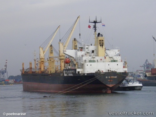
 Judi Alamar
Current Status
Where is the vessel?
Judi Alamar is currently in Near EL DEKHEILA, based on AIS data received less than 1h ago.
Latest AIS update:
Current position: 31.13500° N, 29.79333° E (Near EL DEKHEILA)
Average speed (last 7 days): Loading…
Average speed (last 30 days): Loading…
Vessel profile: Judi Alamar is a Bulk Carrier with dimensions 173m x 27m.
This page combines live AIS, route history, probable destination signals, nearby traffic, and port activity for practical vessel monitoring.
The current position of vessel Judi Alamar is 31.13500 lat / 29.79333 lng. Updated: 2026-05-13 21:09:37 UTCNearest reference points:
- Near Alexandria
- Near EL DEKHEILA
- 13 nm W of EL DEKHEILA
Currently sailing under the flag of Belize ![]()
Judi Alamar built in 1995 year
Deadweight:
28760 tDetails:
Live Vessel Judi Alamar Analytics (details, animations, etc.)
Recent AIS points (UTC):
2026-05-13 18:09:04 UTC · 31.13560, 29.79473 · SOG 0 kn · COG -1°2026-05-13 18:59:48 UTC · 31.13500, 29.79333 · SOG 0 kn · COG -1°
2026-05-13 20:09:07 UTC · 31.13500, 29.79333 · SOG 0 kn · COG -1°
2026-05-13 21:09:37 UTC · 31.13500, 29.79333 · SOG 0 kn · COG -1°