 vesseltracker.com
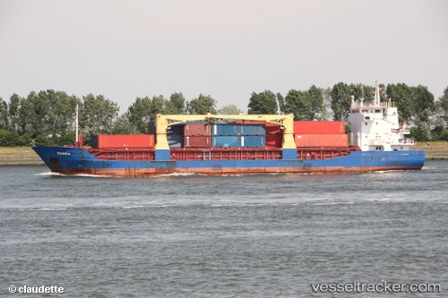
Meratus Sangatta
Current StatusWhere is the vessel?
Meratus Sangatta is currently in Near Tanjung Merangas, based on AIS data received less than 1h ago.
Latest AIS update:
Current position: 0.15218° N, 117.58028° E (Near Tanjung Merangas)
Average speed (last 7 days): Loading…
Average speed (last 30 days): Loading…
Vessel profile: Meratus Sangatta is a Multi Purpose Carrier with dimensions 14m x 88m.
This page combines live AIS, route history, probable destination signals, nearby traffic, and port activity for practical vessel monitoring.
The current position of vessel Meratus Sangatta is 0.15218 lat / 117.58028 lng. Updated: 2026-05-01 05:34:01 UTCNearest reference points:
- Near TANJUNG BARA
- Near Santan Terminal
- 16 nm SE of Santan Terminal
Details:
Live Vessel Meratus Sangatta Analytics (details, animations, etc.)
Recent AIS points (UTC):
2026-05-01 01:25:02 UTC · 0.15170, 117.58089 · SOG 0.1 kn · COG 6°2026-05-01 03:49:02 UTC · 0.15182, 117.58075 · SOG 0.1 kn · COG 18°
2026-05-01 04:40:02 UTC · 0.15201, 117.58050 · SOG 0 kn · COG 40°
2026-05-01 05:34:01 UTC · 0.15218, 117.58028 · SOG 0 kn · COG 57°