 vesseltracker.com
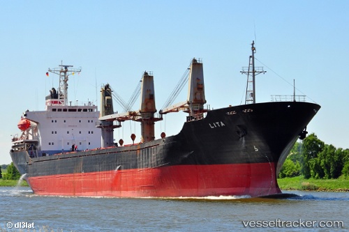
 Lita
Lita
Current Status
Where is the vessel?
Lita is currently in Near Górki Zachodnie, based on AIS data received less than 1h ago.
Latest AIS update:
Current position: 54.44438° N, 18.82704° E (Near Górki Zachodnie)
Average speed (last 7 days): Loading…
Average speed (last 30 days): Loading…
Vessel profile: Lita is a Bulk Carrier with dimensions 148m x 148m.
This page combines live AIS, route history, probable destination signals, nearby traffic, and port activity for practical vessel monitoring.
The current position of vessel Lita is 54.44438 lat / 18.82704 lng. Updated: 2026-05-17 10:10:30 UTCNearest reference points:
- Near Górki Zachodnie
- Near Nowy Port/Gdansk
- Near Sopot
Currently sailing under the flag of Liberia ![]()
Lita built in 1995 year
Deadweight:
18305 tDetails:
Live Vessel Lita Analytics (details, animations, etc.)
Recent AIS points (UTC):
2026-05-17 05:28:30 UTC · 54.44448, 18.83090 · SOG 0 kn · COG 285°2026-05-17 07:10:29 UTC · 54.44402, 18.83049 · SOG 0 kn · COG 310°
2026-05-17 08:16:28 UTC · 54.44363, 18.82905 · SOG 0.1 kn · COG 354°
2026-05-17 10:10:30 UTC · 54.44438, 18.82704 · SOG 0 kn · COG 61°