 vesseltracker.com
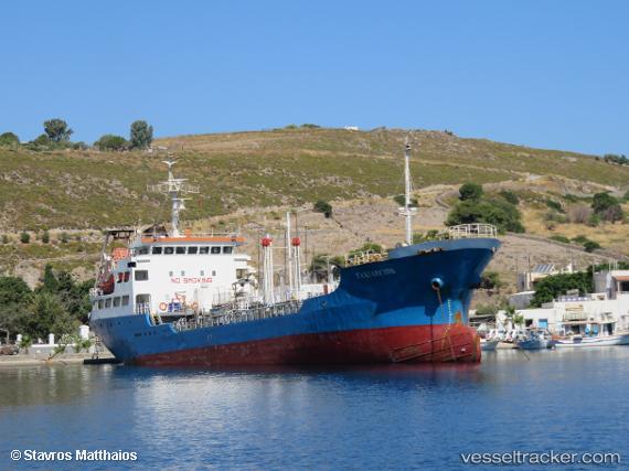
 QUEEN MAJEDA
Current Status
Where is the vessel?
QUEEN MAJEDA is currently in Near Durres, based on AIS data received about 1129d ago.
Latest AIS update:
Current position: 41.30406° N, 19.45267° E (Near Durres)
Average speed (last 7 days): Loading…
Average speed (last 30 days): Loading…
Vessel profile: QUEEN MAJEDA is a Oil Products Tanker with dimensions 72m x 12m.
This page combines live AIS, route history, probable destination signals, nearby traffic, and port activity for practical vessel monitoring.
The current position of vessel QUEEN MAJEDA is 41.30406 lat / 19.45267 lng. Updated: 2023-04-10 23:53:26 UTCNearest reference points:
- Near Durres
- 22 nm W of Fier
- Near TIVAT
Currently sailing under the flag of Cameroon ![]()
QUEEN MAJEDA built in 1994 year
Deadweight:
2547 tDetails:
Live Vessel QUEEN MAJEDA Analytics (details, animations, etc.)
Recent AIS points (UTC):
2023-04-10 23:53:26 UTC · 41.30406, 19.45267 · SOG 0 kn · COG -1°