 vesseltracker.com
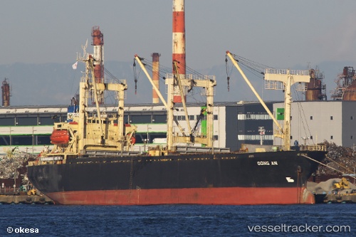
 Dong An
Current Status
Where is the vessel?
Dong An is currently in Near Cat Lai Oil Port, based on AIS data received less than 1h ago.
Latest AIS update:
Current position: 10.73008° N, 106.76399° E (Near Cat Lai Oil Port)
Average speed (last 7 days): Loading…
Average speed (last 30 days): Loading…
Vessel profile: Dong An is a General Cargo Ship with dimensions 99m x 99m.
This page combines live AIS, route history, probable destination signals, nearby traffic, and port activity for practical vessel monitoring.
The current position of vessel Dong An is 10.73008 lat / 106.76399 lng. Updated: 2026-04-22 07:28:18 UTCNearest reference points:
- Near Cat Lai Oil Port
- Near Nha Be
- Near Saigon Petro Oil Terminal
Currently sailing under the flag of Vietnam ![]()
Dong An built in 1995 year
Deadweight:
7091 tDetails:
Live Vessel Dong An Analytics (details, animations, etc.)
Recent AIS points (UTC):
2026-04-22 04:23:44 UTC · 10.72997, 106.76382 · SOG 0.1 kn · COG -1°2026-04-22 06:13:54 UTC · 10.73004, 106.76385 · SOG 0.2 kn · COG -1°
2026-04-22 07:20:24 UTC · 10.73011, 106.76390 · SOG 0.1 kn · COG -1°
2026-04-22 07:28:18 UTC · 10.73008, 106.76399 · SOG 0.1 kn · COG -1°