 vesseltracker.com
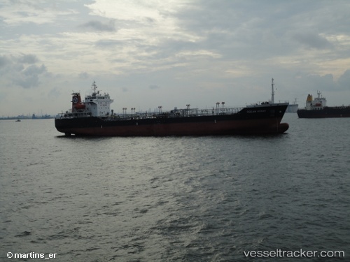
 RAY
RAY
Current Status
Where is the vessel?
RAY is currently in 43 nm NE of PENGERANG, based on AIS data received less than 1h ago.
Latest AIS update:
Current position: 1.75333° N, 104.74667° E (43 nm NE of PENGERANG)
Average speed (last 7 days): Loading…
Average speed (last 30 days): Loading…
Vessel profile: RAY is a Oil Products Tanker with dimensions m x m.
This page combines live AIS, route history, probable destination signals, nearby traffic, and port activity for practical vessel monitoring.
The current position of vessel RAY is 1.75333 lat / 104.74667 lng. Updated: 2026-05-16 06:01:38 UTCNearest reference points:
- 45 nm NE of PENGERANG
- 47 nm NE of PENGERANG
- 51 nm NE of PENGERANG
Currently sailing under the flag of Belize ![]()
Details:
Live Vessel RAY Analytics (details, animations, etc.)
Recent AIS points (UTC):
2026-05-16 02:16:36 UTC · 1.75333, 104.74667 · SOG 0 kn · COG -1°2026-05-16 03:25:39 UTC · 1.75333, 104.74667 · SOG 0 kn · COG -1°
2026-05-16 04:42:28 UTC · 1.75426, 104.74741 · SOG 0 kn · COG 295°
2026-05-16 06:01:38 UTC · 1.75333, 104.74667 · SOG 0 kn · COG -1°