 vesseltracker.com
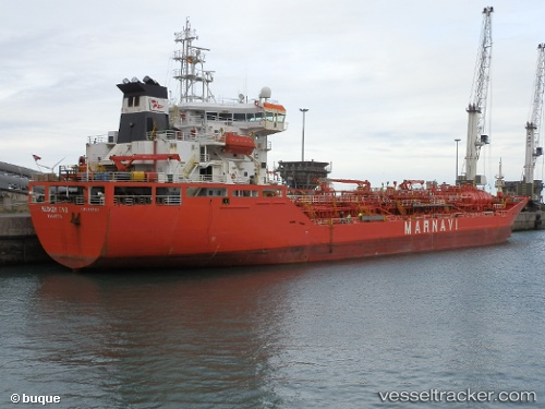
Tsm Polaris
Current StatusWhere is the vessel?
Tsm Polaris is currently in 119 nm SW of White Rose Field, based on AIS data received about 67d ago.
Latest AIS update:
Current position: 45.64913° N, 50.35262° W (119 nm SW of White Rose Field)
Average speed (last 7 days): Loading…
Average speed (last 30 days): Loading…
Vessel profile: Tsm Polaris is a Chemical Oil Products Tanker with dimensions 20m x 146m.
This page combines live AIS, route history, probable destination signals, nearby traffic, and port activity for practical vessel monitoring.
The current position of vessel Tsm Polaris is 45.64913 lat / -50.35262 lng. Updated: 2026-02-24 14:37:59 UTCNearest reference points:
- 24 nm SW of White Rose Field
- Near Witless Bay
- Near St. John’S
Details:
Live Vessel Tsm Polaris Analytics (details, animations, etc.)
Recent AIS points (UTC):
2026-02-24 14:37:59 UTC · 45.64913, -50.35262 · SOG 67.1 kn · COG 315°