 vesseltracker.com
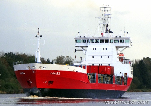
 Laura
Laura
Current Status
Where is the vessel?
Laura is currently in Near Röyttä, based on AIS data received less than 1h ago.
Latest AIS update:
Current position: 65.75360° N, 24.16191° E (Near Röyttä)
Average speed (last 7 days): Loading…
Average speed (last 30 days): Loading…
Vessel profile: Laura is a Multi Purpose Carrier with dimensions 120m x 18m.
This page combines live AIS, route history, probable destination signals, nearby traffic, and port activity for practical vessel monitoring.
The current position of vessel Laura is 65.75360 lat / 24.16191 lng. Updated: 2026-05-15 11:41:36 UTCNearest reference points:
- Near Karlsborg Axelvik
Currently sailing under the flag of Finland ![]()
Laura built in 1996 year
Deadweight:
6410 tDetails:
Live Vessel Laura Analytics (details, animations, etc.)
Recent AIS points (UTC):
2026-05-15 07:50:34 UTC · 65.75352, 24.16188 · SOG 0.1 kn · COG 238°2026-05-15 09:39:12 UTC · 65.75351, 24.16187 · SOG 0 kn · COG 239°
2026-05-15 10:29:36 UTC · 65.75351, 24.16188 · SOG 0 kn · COG 239°
2026-05-15 11:41:36 UTC · 65.75360, 24.16191 · SOG 0 kn · COG 239°