 vesseltracker.com
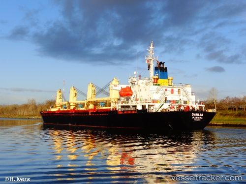
Dahlia
Current StatusWhere is the vessel?
Dahlia is currently in Near ARATU, based on AIS data received less than 1h ago.
Latest AIS update:
Current position: 12.78683° S, 38.47853° W (Near ARATU)
Average speed (last 7 days): Loading…
Average speed (last 30 days): Loading…
Vessel profile: Dahlia is a Bulk Carrier with dimensions 24m x 145m.
This page combines live AIS, route history, probable destination signals, nearby traffic, and port activity for practical vessel monitoring.
The current position of vessel Dahlia is -12.78683 lat / -38.47853 lng. Updated: 2026-05-14 06:08:52 UTCNearest reference points:
- Near Aracaju
- Near Barra dos Coqueiros
Details:
Live Vessel Dahlia Analytics (details, animations, etc.)
Recent AIS points (UTC):
2026-05-14 02:50:51 UTC · -12.78684, -38.47851 · SOG 0 kn · COG 60°2026-05-14 03:35:48 UTC · -12.78681, -38.47849 · SOG 0 kn · COG 60°
2026-05-14 04:02:50 UTC · -12.78687, -38.47852 · SOG 0 kn · COG 60°
2026-05-14 06:08:52 UTC · -12.78683, -38.47853 · SOG 0 kn · COG 60°