 vesseltracker.com
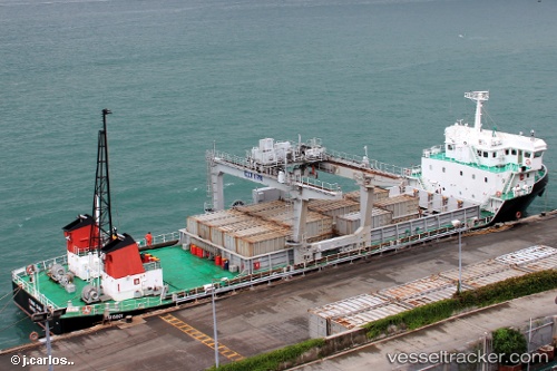
 TSING CHAU
Current Status
Where is the vessel?
TSING CHAU is currently in Near Kennedy Town, based on AIS data received about 1h ago.
Latest AIS update:
Current position: 22.29857° N, 114.12301° E (Near Kennedy Town)
Average speed (last 7 days): Loading…
Average speed (last 30 days): Loading…
Vessel profile: TSING CHAU is a Cargo with dimensions m x m.
This page combines live AIS, route history, probable destination signals, nearby traffic, and port activity for practical vessel monitoring.
The current position of vessel TSING CHAU is 22.29857 lat / 114.12301 lng. Updated: 2026-05-02 22:05:32 UTCNearest reference points:
- Near Kennedy Town
- Near Shek Tong Tsui
- Near Sham Shui Po
Currently sailing under the flag of Hong Kong ![]()
Details:
Live Vessel TSING CHAU Analytics (details, animations, etc.)
Recent AIS points (UTC):
2026-05-02 19:56:23 UTC · 22.29832, 114.12304 · SOG 0.1 kn · COG -1°2026-05-02 20:12:32 UTC · 22.29836, 114.12305 · SOG 0 kn · COG -1°
2026-05-02 21:58:34 UTC · 22.29855, 114.12301 · SOG 0.1 kn · COG -1°
2026-05-02 22:05:32 UTC · 22.29857, 114.12301 · SOG 0.1 kn · COG -1°