 vesseltracker.com
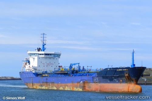
 MT ALGO
Current Status
Where is the vessel?
MT ALGO is currently in Near Malabo, based on AIS data received about 2d ago.
Latest AIS update:
Current position: 3.76357° N, 8.77236° E (Near Malabo)
Average speed (last 7 days): Loading…
Average speed (last 30 days): Loading…
Vessel profile: MT ALGO is a Chemical Tanker with dimensions m x m.
This page combines live AIS, route history, probable destination signals, nearby traffic, and port activity for practical vessel monitoring.
The current position of vessel MT ALGO is 3.76357 lat / 8.77236 lng. Updated: 2026-05-13 02:53:12 UTCNearest reference points:
- Near Moudi Terminal
- Near Victoria
- Near Odudu Terminal
Currently sailing under the flag of Liberia ![]()
Details:
Live Vessel MT ALGO Analytics (details, animations, etc.)
Recent AIS points (UTC):
2026-05-12 17:02:01 UTC · 3.76358, 8.77241 · SOG 0 kn · COG 149°2026-05-13 02:53:12 UTC · 3.76357, 8.77236 · SOG 0 kn · COG 148°
2026-05-13 02:53:12 UTC · 3.76357, 8.77236 · SOG 0 kn · COG 148°
2026-05-13 02:53:12 UTC · 3.76357, 8.77236 · SOG 0 kn · COG 148°