 vesseltracker.com
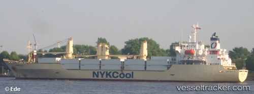
 Crown Opal
Current Status
Where is the vessel?
Crown Opal is currently in Near WALVIS BAY, based on AIS data received about 1h ago.
Latest AIS update:
Current position: 22.85950° S, 14.51874° E (Near WALVIS BAY)
Average speed (last 7 days): Loading…
Average speed (last 30 days): Loading…
Vessel profile: Crown Opal is a Refrigerated Cargo Ship with dimensions 152m x 23m.
This page combines live AIS, route history, probable destination signals, nearby traffic, and port activity for practical vessel monitoring.
The current position of vessel Crown Opal is -22.85950 lat / 14.51874 lng. Updated: 2026-05-14 20:03:10 UTCNearest reference points:
- Near WALVIS BAY
Currently sailing under the flag of Bahamas ![]()
Crown Opal built in 1997 year
Deadweight:
10316 tDetails:
Live Vessel Crown Opal Analytics (details, animations, etc.)
Recent AIS points (UTC):
2026-05-14 16:18:10 UTC · -22.85943, 14.51870 · SOG 0.1 kn · COG 234°2026-05-14 17:21:11 UTC · -22.85948, 14.51872 · SOG 0.2 kn · COG 236°
2026-05-14 19:42:10 UTC · -22.85953, 14.51875 · SOG 0.1 kn · COG 241°
2026-05-14 20:03:10 UTC · -22.85950, 14.51874 · SOG 0.1 kn · COG 241°