 vesseltracker.com
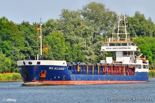
 Rix Alliance
Current Status
Where is the vessel?
Rix Alliance is currently in Near Frederikshavn, based on AIS data received less than 1h ago.
Latest AIS update:
Current position: 57.40548° N, 10.77266° E (Near Frederikshavn)
Average speed (last 7 days): Loading…
Average speed (last 30 days): Loading…
Vessel profile: Rix Alliance is a Multi Purpose Carrier with dimensions 88m x 11m.
This page combines live AIS, route history, probable destination signals, nearby traffic, and port activity for practical vessel monitoring.
The current position of vessel Rix Alliance is 57.40548 lat / 10.77266 lng. Updated: 2026-05-14 05:45:51 UTCNearest reference points:
- Near Frederikshavn
- Near SKAGEN
- 19 nm E of Sæby
Currently sailing under the flag of Cyprus ![]()
Rix Alliance built in 1995 year
Deadweight:
3002 tDetails:
Live Vessel Rix Alliance Analytics (details, animations, etc.)
Recent AIS points (UTC):
2026-05-14 01:31:43 UTC · 57.99673, 10.81266 · SOG 8.6 kn · COG 178°2026-05-14 03:43:21 UTC · 57.67720, 10.92995 · SOG 8.5 kn · COG 194°
2026-05-14 04:34:51 UTC · 57.55974, 10.85606 · SOG 8.9 kn · COG 204°
2026-05-14 05:45:51 UTC · 57.40548, 10.77266 · SOG 7.9 kn · COG 202°