 vesseltracker.com
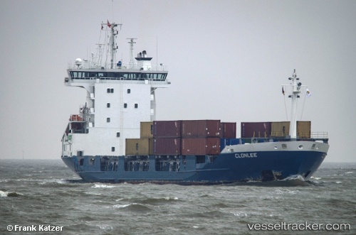
 Nabiha
Current Status
Where is the vessel?
Nabiha is currently in Near Tunarica, based on AIS data received less than 1h ago.
Latest AIS update:
Current position: 44.95282° N, 14.10215° E (Near Tunarica)
Average speed (last 7 days): Loading…
Average speed (last 30 days): Loading…
Vessel profile: Nabiha is a Container Ship with dimensions 100m x 18m.
This page combines live AIS, route history, probable destination signals, nearby traffic, and port activity for practical vessel monitoring.
The current position of vessel Nabiha is 44.95282 lat / 14.10215 lng. Updated: 2026-05-14 11:36:32 UTCNearest reference points:
- Near Pula
- Near VALBISKA
- Near Rijeka
Currently sailing under the flag of Panama ![]()
Nabiha built in 1996 year
Deadweight:
5207 tDetails:
Live Vessel Nabiha Analytics (details, animations, etc.)
Recent AIS points (UTC):
2026-05-14 08:18:27 UTC · 44.95126, 14.09995 · SOG 0.2 kn · COG 106°2026-05-14 10:12:30 UTC · 44.95280, 14.10190 · SOG 0.1 kn · COG 179°
2026-05-14 10:39:30 UTC · 44.95283, 14.10194 · SOG 0.1 kn · COG 180°
2026-05-14 11:36:32 UTC · 44.95282, 14.10215 · SOG 0.2 kn · COG 194°