 vesseltracker.com
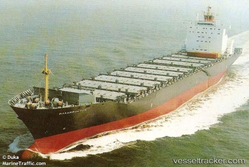
 VLADIVOSTOK
Current Status
Where is the vessel?
VLADIVOSTOK is currently in 12 nm SE of Nam Hai Dinh Vu Port, based on AIS data received less than 1h ago.
Latest AIS update:
Current position: 20.66500° N, 106.97667° E (12 nm SE of Nam Hai Dinh Vu Port)
Average speed (last 7 days): Loading…
Average speed (last 30 days): Loading…
Vessel profile: VLADIVOSTOK is a Container Ship with dimensions m x m.
This page combines live AIS, route history, probable destination signals, nearby traffic, and port activity for practical vessel monitoring.
The current position of vessel VLADIVOSTOK is 20.66500 lat / 106.97667 lng. Updated: 2026-04-25 10:02:02 UTCNearest reference points:
- 12 nm SE of Nam Hai Dinh Vu Port
- 14 nm SE of Nam Hai Dinh Vu Port
- Near Nam Hai Dinh Vu Port
Currently sailing under the flag of Sierra Leone ![]()
Details:
Live Vessel VLADIVOSTOK Analytics (details, animations, etc.)
Recent AIS points (UTC):
2026-04-25 07:34:35 UTC · 20.29036, 106.96909 · SOG 11 kn · COG 339°2026-04-25 07:34:35 UTC · 20.29036, 106.96909 · SOG 11 kn · COG 339°
2026-04-25 09:47:18 UTC · 20.65641, 106.91867 · SOG 13.5 kn · COG 80°
2026-04-25 10:02:02 UTC · 20.66500, 106.97667 · SOG 13 kn · COG -1°