 vesseltracker.com
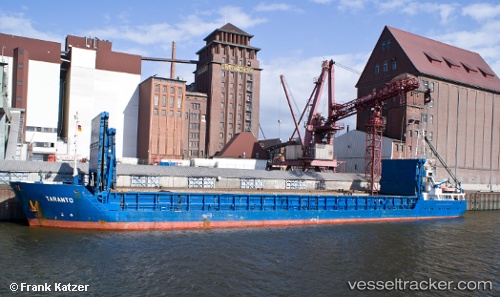
 ALYA
ALYA
Current Status
Where is the vessel?
ALYA is currently in 13 nm S of Banyeres del Penedes, based on AIS data received less than 1h ago.
Latest AIS update:
Current position: 40.89518° N, 1.42728° E (13 nm S of Banyeres del Penedes)
Average speed (last 7 days): Loading…
Average speed (last 30 days): Loading…
Vessel profile: ALYA is a General Cargo Ship with dimensions 88m x 11m.
This page combines live AIS, route history, probable destination signals, nearby traffic, and port activity for practical vessel monitoring.
The current position of vessel ALYA is 40.89518 lat / 1.42728 lng. Updated: 2026-05-16 14:06:24 UTCNearest reference points:
- Near RODA DE BARA
- Near Tarragona
- 16 nm SW of Sampedor
Currently sailing under the flag of Panama ![]()
ALYA built in 1995 year
Deadweight:
3005 tDetails:
Live Vessel ALYA Analytics (details, animations, etc.)
Recent AIS points (UTC):
2026-05-16 04:41:54 UTC · 39.84866, 0.87479 · SOG 6.8 kn · COG 19°2026-05-16 12:23:59 UTC · 40.78803, 1.13580 · SOG 8.2 kn · COG 41°
2026-05-16 14:03:14 UTC · 40.89174, 1.41763 · SOG 9.1 kn · COG 68°
2026-05-16 14:06:24 UTC · 40.89518, 1.42728 · SOG 9.1 kn · COG 69°