 vesseltracker.com
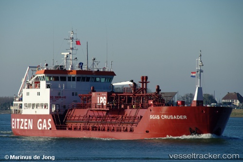
 GAS CRUSADER
Current Status
Where is the vessel?
GAS CRUSADER is currently in Near SUNGAI UDANG, based on AIS data received about 1h ago.
Latest AIS update:
Current position: 2.19122° N, 102.16525° E (Near SUNGAI UDANG)
Average speed (last 7 days): Loading…
Average speed (last 30 days): Loading…
Vessel profile: GAS CRUSADER is a LPG Tanker with dimensions 74m x 14m.
This page combines live AIS, route history, probable destination signals, nearby traffic, and port activity for practical vessel monitoring.
The current position of vessel GAS CRUSADER is 2.19122 lat / 102.16525 lng. Updated: 2026-04-25 23:30:52 UTCNearest reference points:
- Near SUNGAI UDANG
- Near Malacca
- Near MELAKA
Currently sailing under the flag of Malaysia ![]()
GAS CRUSADER built in 1996 year
Deadweight:
2347 tDetails:
Live Vessel GAS CRUSADER Analytics (details, animations, etc.)
Recent AIS points (UTC):
2026-04-25 20:09:55 UTC · 2.19084, 102.16654 · SOG 0.1 kn · COG 309°2026-04-25 22:09:53 UTC · 2.19108, 102.16539 · SOG 0 kn · COG 91°
2026-04-25 22:22:14 UTC · 2.19104, 102.16539 · SOG 0 kn · COG 83°
2026-04-25 23:30:52 UTC · 2.19122, 102.16525 · SOG 0 kn · COG 90°