 vesseltracker.com
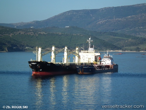
 RUKIA
RUKIA
Current Status
Where is the vessel?
RUKIA is currently in 25 nm SE of Agbami, based on AIS data received about 1h ago.
Latest AIS update:
Current position: 3.19403° N, 5.78843° E (25 nm SE of Agbami)
Average speed (last 7 days): Loading…
Average speed (last 30 days): Loading…
Vessel profile: RUKIA is a Bulk Carrier with dimensions 26m x 151m.
This page combines live AIS, route history, probable destination signals, nearby traffic, and port activity for practical vessel monitoring.
The current position of vessel RUKIA is 3.19403 lat / 5.78843 lng. Updated: 2026-05-01 17:42:47 UTCNearest reference points:
- 12 nm N of Okwori
- 21 nm SW of Bonny
- 12 nm SE of Okono
Currently sailing under the flag of St.Kitts and Nevis ![]()
RUKIA built in 1996 year
Deadweight:
23709 tDetails:
Live Vessel RUKIA Analytics (details, animations, etc.)
Recent AIS points (UTC):
2026-05-01 13:26:46 UTC · 2.92392, 6.33361 · SOG 8.9 kn · COG 274°2026-05-01 13:50:47 UTC · 2.93576, 6.27733 · SOG 8.5 kn · COG 280°
2026-05-01 15:42:06 UTC · 3.01383, 6.02382 · SOG 9.3 kn · COG 303°
2026-05-01 17:42:47 UTC · 3.19403, 5.78843 · SOG 8.8 kn · COG 304°