 vesseltracker.com
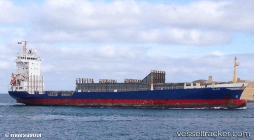
 LUCIA
LUCIA
Current Status
Where is the vessel?
LUCIA is currently in 111 nm W of Kiamari, based on AIS data received about 6h ago.
Latest AIS update:
Current position: 24.40486° N, 64.99051° E (111 nm W of Kiamari)
Average speed (last 7 days): Loading…
Average speed (last 30 days): Loading…
Vessel profile: LUCIA is a Container Ship with dimensions 122m x 122m.
This page combines live AIS, route history, probable destination signals, nearby traffic, and port activity for practical vessel monitoring.
The current position of vessel LUCIA is 24.40486 lat / 64.99051 lng. Updated: 2026-05-17 01:00:26 UTCNearest reference points:
- 147 nm SW of Kiamari
- 84 nm SW of Keti Bandar
- 16 nm S of Kiamari
Currently sailing under the flag of St.Kitts and Nevis ![]()
LUCIA built in 1997 year
Deadweight:
7225 tDetails:
Live Vessel LUCIA Analytics (details, animations, etc.)
Recent AIS points (UTC):
2026-05-17 01:00:26 UTC · 24.40486, 64.99051 · SOG 8.1 kn · COG 255°2026-05-17 01:00:26 UTC · 24.40486, 64.99051 · SOG 8.1 kn · COG 255°
2026-05-17 01:00:26 UTC · 24.40486, 64.99051 · SOG 8.1 kn · COG 255°
2026-05-17 01:00:26 UTC · 24.40486, 64.99051 · SOG 8.1 kn · COG 255°