 vesseltracker.com
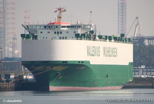
 DON QUIJOTE
Current Status
Where is the vessel?
DON QUIJOTE is currently in 253 nm SW of Santa Rosa Island, based on AIS data received less than 1h ago.
Latest AIS update:
Current position: 31.26568° N, 123.95215° W (253 nm SW of Santa Rosa Island)
Average speed (last 7 days): Loading…
Average speed (last 30 days): Loading…
Vessel profile: DON QUIJOTE is a Vehicles Carrier with dimensions m x m.
This page combines live AIS, route history, probable destination signals, nearby traffic, and port activity for practical vessel monitoring.
The current position of vessel DON QUIJOTE is 31.26568 lat / -123.95215 lng. Updated: 2026-05-15 04:35:50 UTCNearest reference points:
- Open sea, approx. 402 nm off the nearest listed port
- Open sea, approx. 403 nm off the nearest listed port
- Open sea, approx. 408 nm off the nearest listed port
Currently sailing under the flag of Norway ![]()
Details:
Live Vessel DON QUIJOTE Analytics (details, animations, etc.)
Recent AIS points (UTC):
2026-05-15 00:02:38 UTC · 32.01713, -125.15167 · SOG 16.5 kn · COG 123°2026-05-15 01:20:01 UTC · 31.80604, -124.81117 · SOG 16.8 kn · COG 123°
2026-05-15 03:23:11 UTC · 31.45833, -124.27167 · SOG 16 kn · COG -1°
2026-05-15 04:35:50 UTC · 31.26568, -123.95215 · SOG 16.9 kn · COG 122°