 vesseltracker.com
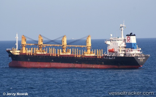
 SMS PANAMERA
Current Status
Where is the vessel?
SMS PANAMERA is currently in Near GEMLIK, based on AIS data received less than 1h ago.
Latest AIS update:
Current position: 40.43928° N, 29.10932° E (Near GEMLIK)
Average speed (last 7 days): Loading…
Average speed (last 30 days): Loading…
Vessel profile: SMS PANAMERA is a Bulk Carrier with dimensions m x m.
This page combines live AIS, route history, probable destination signals, nearby traffic, and port activity for practical vessel monitoring.
The current position of vessel SMS PANAMERA is 40.43928 lat / 29.10932 lng. Updated: 2026-05-15 04:16:25 UTCNearest reference points:
- Near GEMLIK
- 11 nm S of Maltepe
- 14 nm SW of Maltepe
Currently sailing under the flag of Saint Kitts and Nevis ![]()
Details:
Live Vessel SMS PANAMERA Analytics (details, animations, etc.)
Recent AIS points (UTC):
2026-05-14 23:59:44 UTC · 40.43905, 29.10949 · SOG 0 kn · COG -1°2026-05-15 01:00:08 UTC · 40.43905, 29.10965 · SOG 0 kn · COG -1°
2026-05-15 04:04:20 UTC · 40.43932, 29.10952 · SOG 0.1 kn · COG -1°
2026-05-15 04:16:25 UTC · 40.43928, 29.10932 · SOG 0 kn · COG -1°