 vesseltracker.com
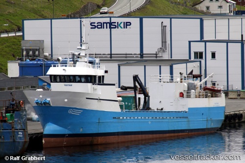
Vesthav
Current StatusWhere is the vessel?
Vesthav is currently in Near SANDUR, based on AIS data received about 1h ago.
Latest AIS update:
Current position: 61.72338° N, 6.58854° W (Near SANDUR)
Average speed (last 7 days): Loading…
Average speed (last 30 days): Loading…
Vessel profile: Vesthav is a Fish Carrier with dimensions 8m x 40m.
This page combines live AIS, route history, probable destination signals, nearby traffic, and port activity for practical vessel monitoring.
The current position of vessel Vesthav is 61.72338 lat / -6.58854 lng. Updated: 2026-05-15 17:33:28 UTCNearest reference points:
- Near FUGLAFJORDUR
- 20 nm S of Vágur
- Near VESTMANNA
Details:
Live Vessel Vesthav Analytics (details, animations, etc.)
Recent AIS points (UTC):
2026-05-15 13:52:38 UTC · 62.09167, -6.73970 · SOG 0 kn · COG 358°2026-05-15 15:59:29 UTC · 61.91531, -6.65173 · SOG 8.1 kn · COG 158°
2026-05-15 16:37:47 UTC · 61.83688, -6.59344 · SOG 7.7 kn · COG 160°
2026-05-15 17:33:28 UTC · 61.72338, -6.58854 · SOG 7.6 kn · COG 186°