 vesseltracker.com
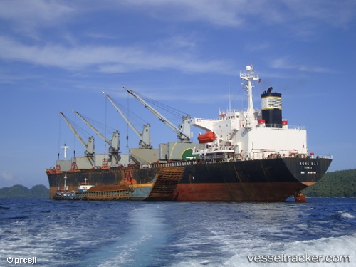
Hong Kai
Current StatusWhere is the vessel?
Hong Kai is currently in Near Chalna, based on AIS data received less than 1h ago.
Latest AIS update:
Current position: 22.32793° N, 89.62960° E (Near Chalna)
Average speed (last 7 days): Loading…
Average speed (last 30 days): Loading…
Vessel profile: Hong Kai is a Bulk Carrier with dimensions 31m x 186m.
This page combines live AIS, route history, probable destination signals, nearby traffic, and port activity for practical vessel monitoring.
The current position of vessel Hong Kai is 22.32793 lat / 89.62960 lng. Updated: 2026-05-16 11:42:14 UTCNearest reference points:
- Near Calcutta
- Near Haldia
- 16 nm SE of Contai
Details:
Live Vessel Hong Kai Analytics (details, animations, etc.)
Recent AIS points (UTC):
2026-05-16 05:33:10 UTC · 22.33356, 89.63103 · SOG 0.1 kn · COG 205°2026-05-16 10:10:06 UTC · 22.32833, 89.62833 · SOG 0 kn · COG -1°
2026-05-16 10:19:11 UTC · 22.32833, 89.62833 · SOG 0 kn · COG -1°
2026-05-16 11:42:14 UTC · 22.32793, 89.62960 · SOG 0 kn · COG 25°