 vesseltracker.com
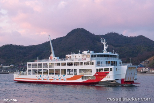
Orange Gureisu
Current StatusWhere is the vessel?
Orange Gureisu is currently in Near Tsuzu Yamaguchi, based on AIS data received less than 1h ago.
Latest AIS update:
Current position: 33.95627° N, 132.13268° E (Near Tsuzu Yamaguchi)
Average speed (last 7 days): Loading…
Average speed (last 30 days): Loading…
Vessel profile: Orange Gureisu is a Passenger Ro Ro Cargo Ship with dimensions 14m x 61m.
This page combines live AIS, route history, probable destination signals, nearby traffic, and port activity for practical vessel monitoring.
The current position of vessel Orange Gureisu is 33.95627 lat / 132.13268 lng. Updated: 2026-04-28 05:44:26 UTCNearest reference points:
- 13 nm SE of HIKARI
- 14 nm SE of HIKARI
- 18 nm SE of HIKARI
Details:
Live Vessel Orange Gureisu Analytics (details, animations, etc.)
Recent AIS points (UTC):
2026-04-28 01:35:33 UTC · 33.92739, 132.50031 · SOG 13.6 kn · COG 134°2026-04-28 03:21:56 UTC · 33.88855, 132.59682 · SOG 12.9 kn · COG 298°
2026-04-28 04:20:36 UTC · 33.97609, 132.37738 · SOG 12.7 kn · COG 287°
2026-04-28 05:44:26 UTC · 33.95627, 132.13268 · SOG 0 kn · COG 192°