 vesseltracker.com
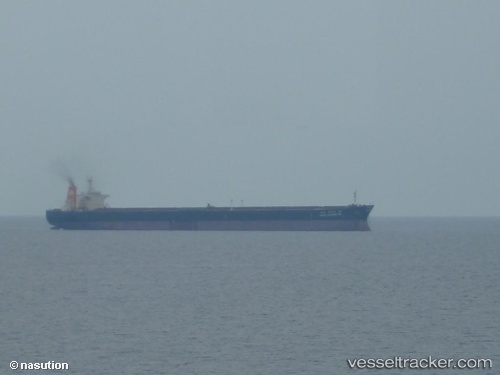
 RICHARDS BAY 1
Current Status
Where is the vessel?
RICHARDS BAY 1 is currently in 48 nm NE of SUR, based on AIS data received about 232d ago.
Latest AIS update:
Current position: 22.98045° N, 60.27237° E (48 nm NE of SUR)
Average speed (last 7 days): Loading…
Average speed (last 30 days): Loading…
Vessel profile: RICHARDS BAY 1 is a Bulk Carrier with dimensions 43m x 269m.
This page combines live AIS, route history, probable destination signals, nearby traffic, and port activity for practical vessel monitoring.
The current position of vessel RICHARDS BAY 1 is 22.98045 lat / 60.27237 lng. Updated: 2025-09-25 04:36:04 UTCNearest reference points:
- 52 nm NE of SUR
- 23 nm NE of Qalhat
- 97 nm S of Chabahar
Currently sailing under the flag of Liberia ![]()
RICHARDS BAY 1 built in 1997 year
Deadweight:
149350 tDetails:
Live Vessel RICHARDS BAY 1 Analytics (details, animations, etc.)
Recent AIS points (UTC):
2025-09-25 04:36:04 UTC · 22.98045, 60.27237 · SOG 12.9 kn · COG 276°