 vesseltracker.com
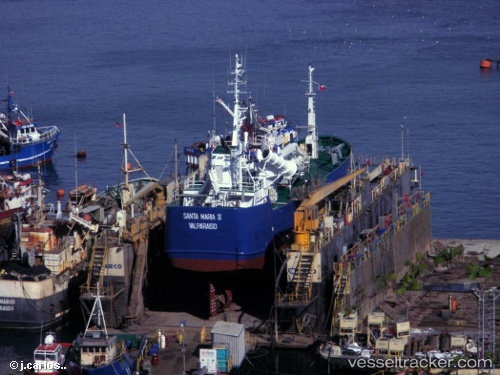
Santa Maria Ii
Current StatusWhere is the vessel?
Santa Maria Ii is currently in Near Lota, based on AIS data received about 2h ago.
Latest AIS update:
Current position: 37.10070° S, 73.16183° W (Near Lota)
Average speed (last 7 days): Loading…
Average speed (last 30 days): Loading…
Vessel profile: Santa Maria Ii is a Fishing Vessel with dimensions 10m x 53m.
This page combines live AIS, route history, probable destination signals, nearby traffic, and port activity for practical vessel monitoring.
The current position of vessel Santa Maria Ii is -37.10070 lat / -73.16183 lng. Updated: 2026-05-14 23:32:03 UTCNearest reference points:
- Near Arauco
Details:
Live Vessel Santa Maria Ii Analytics (details, animations, etc.)
Recent AIS points (UTC):
2026-05-14 19:43:59 UTC · -37.10071, -73.16189 · SOG 0 kn · COG 67°2026-05-14 21:50:00 UTC · -37.10068, -73.16188 · SOG 0.1 kn · COG 69°
2026-05-14 23:08:02 UTC · -37.10070, -73.16189 · SOG 0 kn · COG 67°
2026-05-14 23:32:03 UTC · -37.10070, -73.16183 · SOG 0.1 kn · COG 69°