 vesseltracker.com
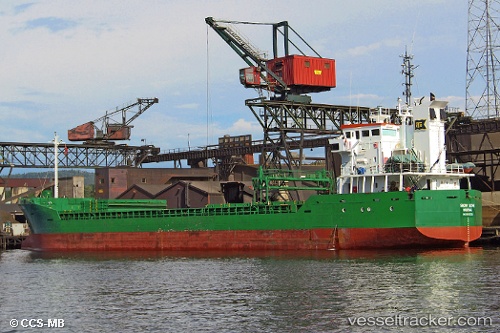
 WALES
WALES
Current Status
Where is the vessel?
WALES is currently in 25 nm SE of El Alquian, based on AIS data received about 1h ago.
Latest AIS update:
Current position: 36.55203° N, 1.98600° W (25 nm SE of El Alquian)
Average speed (last 7 days): Loading…
Average speed (last 30 days): Loading…
Vessel profile: WALES is a General Cargo with dimensions m x m.
This page combines live AIS, route history, probable destination signals, nearby traffic, and port activity for practical vessel monitoring.
The current position of vessel WALES is 36.55203 lat / -1.98600 lng. Updated: 2026-05-16 10:12:05 UTCNearest reference points:
- 27 nm SE of El Alquian
- 26 nm S of El Alquian
- 20 nm SE of CARBONERAS
Currently sailing under the flag of Bahamas ![]()
Details:
Live Vessel WALES Analytics (details, animations, etc.)
Recent AIS points (UTC):
2026-05-16 07:18:06 UTC · 36.78419, -1.66408 · SOG 7.2 kn · COG 231°2026-05-16 07:47:36 UTC · 36.74292, -1.72003 · SOG 7.4 kn · COG 229°
2026-05-16 10:05:14 UTC · 36.56040, -1.97403 · SOG 6.6 kn · COG 233°
2026-05-16 10:12:05 UTC · 36.55203, -1.98600 · SOG 6.6 kn · COG 232°