 vesseltracker.com
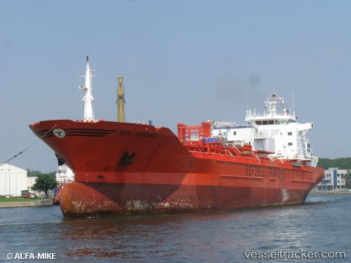
 BOW OCEANIC
Current Status
Where is the vessel?
BOW OCEANIC is currently in 14 nm S of Malacca, based on AIS data received less than 1h ago.
Latest AIS update:
Current position: 1.94218° N, 102.28949° E (14 nm S of Malacca)
Average speed (last 7 days): Loading…
Average speed (last 30 days): Loading…
Vessel profile: BOW OCEANIC is a Chemical/Oil Products Tanker with dimensions 23m x 142m.
This page combines live AIS, route history, probable destination signals, nearby traffic, and port activity for practical vessel monitoring.
The current position of vessel BOW OCEANIC is 1.94218 lat / 102.28949 lng. Updated: 2026-05-15 08:22:52 UTCNearest reference points:
- Near Malacca
- Near MELAKA
- Near SUNGAI UDANG
Currently sailing under the flag of Marshall Islands ![]()
BOW OCEANIC built in 1997 year
Deadweight:
17460 tDetails:
Live Vessel BOW OCEANIC Analytics (details, animations, etc.)
Recent AIS points (UTC):
2026-05-15 04:33:02 UTC · 1.65271, 102.94792 · SOG 11.2 kn · COG 302°2026-05-15 06:07:52 UTC · 1.77566, 102.66921 · SOG 11.7 kn · COG 291°
2026-05-15 08:04:43 UTC · 1.92115, 102.33625 · SOG 10.1 kn · COG 290°
2026-05-15 08:22:52 UTC · 1.94218, 102.28949 · SOG 10 kn · COG 308°