 vesseltracker.com
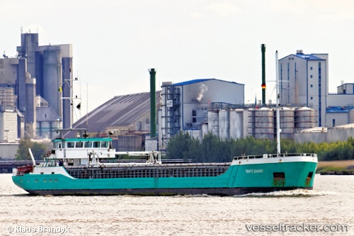
 Waterway
Current Status
Where is the vessel?
Waterway is currently in Near Port-Jérôme, based on AIS data received less than 1h ago.
Latest AIS update:
Current position: 49.44761° N, 0.56159° E (Near Port-Jérôme)
Average speed (last 7 days): Loading…
Average speed (last 30 days): Loading…
Vessel profile: Waterway is a General Cargo Ship with dimensions 81m x 10m.
This page combines live AIS, route history, probable destination signals, nearby traffic, and port activity for practical vessel monitoring.
The current position of vessel Waterway is 49.44761 lat / 0.56159 lng. Updated: 2026-04-30 23:59:46 UTCNearest reference points:
- Near Le Havre
- Near Le Grand-Quevilly
- Near TROUVILLE-SUR-MER
Currently sailing under the flag of St Vincent Grenadines ![]()
Waterway built in 1996 year
Deadweight:
1454 tDetails:
Live Vessel Waterway Analytics (details, animations, etc.)
Recent AIS points (UTC):
2026-04-30 20:00:44 UTC · 49.39347, 0.83597 · SOG 6.1 kn · COG 282°2026-04-30 21:56:15 UTC · 49.51811, 0.75527 · SOG 5 kn · COG 303°
2026-04-30 22:58:06 UTC · 49.47717, 0.66627 · SOG 5.6 kn · COG 181°
2026-04-30 23:59:46 UTC · 49.44761, 0.56159 · SOG 7.5 kn · COG 319°