 vesseltracker.com
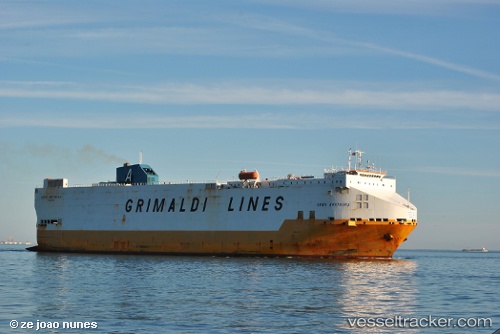
 Gran Bretagna
Current Status
Where is the vessel?
Gran Bretagna is currently in 34 nm SW of Komiza, based on AIS data received less than 1h ago.
Latest AIS update:
Current position: 42.74827° N, 15.41177° E (34 nm SW of Komiza)
Average speed (last 7 days): Loading…
Average speed (last 30 days): Loading…
Vessel profile: Gran Bretagna is a Vehicles Carrier with dimensions 184m x 32m.
This page combines live AIS, route history, probable destination signals, nearby traffic, and port activity for practical vessel monitoring.
The current position of vessel Gran Bretagna is 42.74827 lat / 15.41177 lng. Updated: 2026-05-14 08:01:08 UTCNearest reference points:
- 26 nm N of Isole Tremiti
- Near TERMOLI
- Near Podglavica
Currently sailing under the flag of Italy ![]()
Gran Bretagna built in 1999 year
Deadweight:
18461 tDetails:
Live Vessel Gran Bretagna Analytics (details, animations, etc.)
Recent AIS points (UTC):
2026-05-14 03:43:51 UTC · 41.97474, 16.39062 · SOG 14.9 kn · COG 308°2026-05-14 04:36:26 UTC · 42.10477, 16.15976 · SOG 15 kn · COG 305°
2026-05-14 05:47:08 UTC · 42.30134, 15.86105 · SOG 15.2 kn · COG 308°
2026-05-14 08:01:08 UTC · 42.74827, 15.41177 · SOG 15.2 kn · COG 327°