 vesseltracker.com
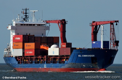
 Samskip Commander
Current Status
Where is the vessel?
Samskip Commander is currently in Near Runde, based on AIS data received about 1h ago.
Latest AIS update:
Current position: 62.42575° N, 5.47939° E (Near Runde)
Average speed (last 7 days): Loading…
Average speed (last 30 days): Loading…
Vessel profile: Samskip Commander is a Container Ship with dimensions 101m x 16m.
This page combines live AIS, route history, probable destination signals, nearby traffic, and port activity for practical vessel monitoring.
The current position of vessel Samskip Commander is 62.42575 lat / 5.47939 lng. Updated: 2026-04-30 17:48:01 UTCNearest reference points:
- Near Gursken
- Near Larsnes
- Near RAUDEBERG
Currently sailing under the flag of Barbados ![]()
Samskip Commander built in 1997 year
Deadweight:
4765 tDetails:
Live Vessel Samskip Commander Analytics (details, animations, etc.)
Recent AIS points (UTC):
2026-04-30 13:55:58 UTC · 62.47519, 6.34124 · SOG 0 kn · COG 320°2026-04-30 15:48:50 UTC · 62.47991, 6.32942 · SOG 9.8 kn · COG 308°
2026-04-30 17:04:11 UTC · 62.44961, 5.76840 · SOG 12.5 kn · COG 271°
2026-04-30 17:48:01 UTC · 62.42575, 5.47939 · SOG 10.9 kn · COG 236°