 Overseas Key West
Current Status
Where is the vessel?
Overseas Key West is currently in Near Port Arthur, based on AIS data received about 15h ago.
Latest AIS update:
Current position: 29.85064° N, 93.97145° W (Near Port Arthur)
Average speed (last 7 days): Loading…
Average speed (last 30 days): Loading…
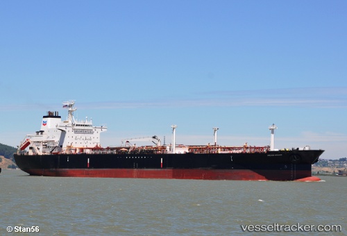
Vessel profile: Overseas Key West is a Chemical Oil Products Tanker with dimensions 189m x 32m.
This page combines live AIS, route history, probable destination signals, nearby traffic, and port activity for practical vessel monitoring.
The current position of vessel Overseas Key West is 29.85064 lat / -93.97145 lng. Updated: 2026-05-24 07:47:53 UTCNearest reference points:
- Near SABINE PASS
- Near Atreco
- Near SUNOCO LOGISTICS
Currently sailing under the flag of USA ![]()
Overseas Key West built in 1999 year
Deadweight:
45671 tDetails:
Live Vessel Overseas Key West Analytics (details, animations, etc.)
Recent AIS points (UTC):
2026-05-24 04:50:52 UTC · 29.85059, -93.97147 · SOG 0 kn · COG 148°2026-05-24 05:23:54 UTC · 29.85061, -93.97147 · SOG 0 kn · COG 148°
2026-05-24 07:44:51 UTC · 29.85065, -93.97141 · SOG 0 kn · COG 148°
2026-05-24 07:47:53 UTC · 29.85064, -93.97145 · SOG 0 kn · COG 148°