 vesseltracker.com
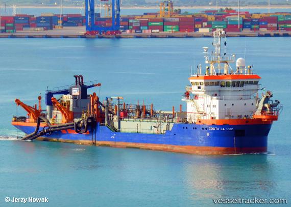
 Costa La Luz
Current Status
Where is the vessel?
Costa La Luz is currently in Near TAN TAN, based on AIS data received less than 1h ago.
Latest AIS update:
Current position: 28.46833° N, 11.35833° W (Near TAN TAN)
Average speed (last 7 days): Loading…
Average speed (last 30 days): Loading…
Vessel profile: Costa La Luz is a Hopper Dredger with dimensions 95m x 17m.
This page combines live AIS, route history, probable destination signals, nearby traffic, and port activity for practical vessel monitoring.
The current position of vessel Costa La Luz is 28.46833 lat / -11.35833 lng. Updated: 2026-05-14 18:06:53 UTCNearest reference points:
- 84 nm NE of ORZOLA
- Near Lanzarote
- Near Aaiun
Currently sailing under the flag of Spain ![]()
Costa La Luz built in 1997 year
Deadweight:
4907 tDetails:
Live Vessel Costa La Luz Analytics (details, animations, etc.)
Recent AIS points (UTC):
2026-05-14 13:54:54 UTC · 28.46667, -11.36167 · SOG 4 kn · COG -1°2026-05-14 15:36:49 UTC · 28.47085, -11.35649 · SOG 1.8 kn · COG 256°
2026-05-14 16:33:56 UTC · 28.47167, -11.35833 · SOG 3 kn · COG -1°
2026-05-14 18:06:53 UTC · 28.46833, -11.35833 · SOG 1 kn · COG -1°