 vesseltracker.com
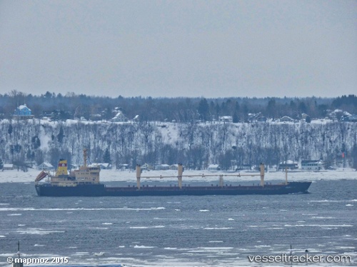
Trapezitza
Current StatusWhere is the vessel?
Trapezitza is currently in Near Puerto Colombia, based on AIS data received less than 1h ago.
Latest AIS update:
Current position: 11.09989° N, 74.91397° W (Near Puerto Colombia)
Average speed (last 7 days): Loading…
Average speed (last 30 days): Loading…
Vessel profile: Trapezitza is a Bulk Carrier with dimensions 25m x 168m.
This page combines live AIS, route history, probable destination signals, nearby traffic, and port activity for practical vessel monitoring.
The current position of vessel Trapezitza is 11.09989 lat / -74.91397 lng. Updated: 2026-05-15 11:26:41 UTCNearest reference points:
- Near Santa Marta
- 18 nm N of Santa Marta
- Near Sociedad Portuaria Regional Cartagena
Details:
Live Vessel Trapezitza Analytics (details, animations, etc.)
Recent AIS points (UTC):
2026-05-15 08:08:40 UTC · 11.09964, -74.91366 · SOG 0.2 kn · COG 44°2026-05-15 09:47:39 UTC · 11.09968, -74.91379 · SOG 0.4 kn · COG 47°
2026-05-15 10:56:37 UTC · 11.09986, -74.91397 · SOG 0.1 kn · COG 50°
2026-05-15 11:26:41 UTC · 11.09989, -74.91397 · SOG 0.5 kn · COG 39°