 vesseltracker.com
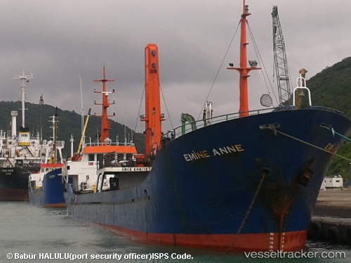
 Emine Anne
Current Status
Where is the vessel?
Emine Anne is currently in Near PENDIK, based on AIS data received less than 1h ago.
Latest AIS update:
Current position: 40.87441° N, 29.20084° E (Near PENDIK)
Average speed (last 7 days): Loading…
Average speed (last 30 days): Loading…
Vessel profile: Emine Anne is a General Cargo Ship with dimensions 69m x 9m.
This page combines live AIS, route history, probable destination signals, nearby traffic, and port activity for practical vessel monitoring.
The current position of vessel Emine Anne is 40.87441 lat / 29.20084 lng. Updated: 2026-05-15 05:38:16 UTCNearest reference points:
- Near PENDIK
- Near TUZLA
- Near Tuzla Free Zone
Currently sailing under the flag of Vanuatu ![]()
Emine Anne built in 1996 year
Deadweight:
1602 tDetails:
Live Vessel Emine Anne Analytics (details, animations, etc.)
Recent AIS points (UTC):
2026-05-15 01:00:59 UTC · 40.67203, 28.93288 · SOG 8.5 kn · COG 46°2026-05-15 04:04:16 UTC · 40.87432, 29.20068 · SOG 0.1 kn · COG 276°
2026-05-15 04:16:18 UTC · 40.87430, 29.20055 · SOG 0.1 kn · COG 281°
2026-05-15 05:38:16 UTC · 40.87441, 29.20084 · SOG 0.1 kn · COG 271°