 vesseltracker.com
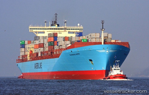
 MSC YUKTA X
Current Status
Where is the vessel?
MSC YUKTA X is currently in Near JINHAI HEAVY INDUSTR, based on AIS data received about 1h ago.
Latest AIS update:
Current position: 30.25332° N, 122.25264° E (Near JINHAI HEAVY INDUSTR)
Average speed (last 7 days): Loading…
Average speed (last 30 days): Loading…
Vessel profile: MSC YUKTA X is a Container Ship with dimensions 346.98m x 42.8m.
This page combines live AIS, route history, probable destination signals, nearby traffic, and port activity for practical vessel monitoring.
The current position of vessel MSC YUKTA X is 30.25332 lat / 122.25264 lng. Updated: 2026-05-02 07:26:52 UTCNearest reference points:
- Near JINHAI HEAVY INDUSTR
- Near Majistan/Zhoushan
- Near ZHOUSHAN
Currently sailing under the flag of Liberia ![]()
MSC YUKTA X built in 1998 year
Deadweight:
119954 tDetails:
Live Vessel MSC YUKTA X Analytics (details, animations, etc.)
Recent AIS points (UTC):
2026-05-02 04:02:38 UTC · 30.25349, 122.25256 · SOG 0 kn · COG -1°2026-05-02 06:02:35 UTC · 30.25332, 122.25264 · SOG 0 kn · COG 88°
2026-05-02 07:22:09 UTC · 30.25332, 122.25264 · SOG 0 kn · COG 88°
2026-05-02 07:26:52 UTC · 30.25332, 122.25264 · SOG 0.1 kn · COG 88°