 vesseltracker.com
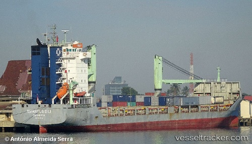
Meratus Dili
Current StatusWhere is the vessel?
Meratus Dili is currently in Near KARIANGAU, based on AIS data received less than 1h ago.
Latest AIS update:
Current position: 1.16227° S, 116.77937° E (Near KARIANGAU)
Average speed (last 7 days): Loading…
Average speed (last 30 days): Loading…
Vessel profile: Meratus Dili is a General Cargo Ship with dimensions 19m x 118m.
This page combines live AIS, route history, probable destination signals, nearby traffic, and port activity for practical vessel monitoring.
The current position of vessel Meratus Dili is -1.16227 lat / 116.77937 lng. Updated: 2026-05-13 23:43:40 UTCNearest reference points:
- Near KARIANGAU
- Near Penajam
- Near Balikpapan
Details:
Live Vessel Meratus Dili Analytics (details, animations, etc.)
Recent AIS points (UTC):
2026-05-13 20:02:40 UTC · -1.16167, 116.77833 · SOG 0 kn · COG -1°2026-05-13 21:58:42 UTC · -1.16221, 116.77938 · SOG 0 kn · COG 331°
2026-05-13 22:12:26 UTC · -1.16167, 116.77833 · SOG 0 kn · COG -1°
2026-05-13 23:43:40 UTC · -1.16227, 116.77937 · SOG 0 kn · COG 330°