 vesseltracker.com
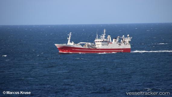
 RUT
RUT
Current Status
Where is the vessel?
RUT is currently in 31 nm SW of Kuril'skiy Burevestnik AFB (Burevestnik AFB), based on AIS data received less than 1h ago.
Latest AIS update:
Current position: 44.48333° N, 147.29500° E (31 nm SW of Kuril'skiy Burevestnik AFB (Burevestnik AFB))
Average speed (last 7 days): Loading…
Average speed (last 30 days): Loading…
Vessel profile: RUT is a Fishing Vessel with dimensions 14m x 67m.
This page combines live AIS, route history, probable destination signals, nearby traffic, and port activity for practical vessel monitoring.
The current position of vessel RUT is 44.48333 lat / 147.29500 lng. Updated: 2026-05-15 19:19:56 UTCNearest reference points:
- Near Yuzhno-Kuril'sk
- 27 nm SE of Tomari
- 11 nm NE of Tomari
Currently sailing under the flag of Russia ![]()
RUT built in 1997 year
Deadweight:
2500 tDetails:
Live Vessel RUT Analytics (details, animations, etc.)
Recent AIS points (UTC):
2026-05-15 15:55:41 UTC · 44.35677, 147.11722 · SOG 4.7 kn · COG 51°2026-05-15 18:07:50 UTC · 44.46667, 147.27499 · SOG 4 kn · COG -1°
2026-05-15 19:13:53 UTC · 44.48667, 147.30167 · SOG 3 kn · COG -1°
2026-05-15 19:19:56 UTC · 44.48333, 147.29500 · SOG 4 kn · COG -1°