 vesseltracker.com
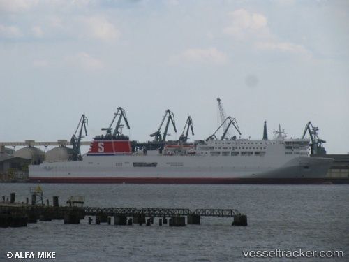
 KAIARAHI
Current Status
Where is the vessel?
KAIARAHI is currently in Near WAIKAWA, based on AIS data received less than 1h ago.
Latest AIS update:
Current position: 41.24398° S, 174.15852° E (Near WAIKAWA)
Average speed (last 7 days): Loading…
Average speed (last 30 days): Loading…
Vessel profile: KAIARAHI is a Passenger/Ro-Ro Ship (vehicles) with dimensions 180m x 25m.
This page combines live AIS, route history, probable destination signals, nearby traffic, and port activity for practical vessel monitoring.
The current position of vessel KAIARAHI is -41.24398 lat / 174.15852 lng. Updated: 2026-04-24 19:50:34 UTCNearest reference points:
- Near WAIKAWA
- Near Renwick
- Near Nelson
Currently sailing under the flag of New Zealand ![]()
KAIARAHI built in 1998 year
Deadweight:
7012 tDetails:
Live Vessel KAIARAHI Analytics (details, animations, etc.)
Recent AIS points (UTC):
2026-04-24 15:48:20 UTC · -41.26473, 174.78786 · SOG 0 kn · COG 347°2026-04-24 16:01:40 UTC · -41.26472, 174.78786 · SOG 0 kn · COG 347°
2026-04-24 17:38:11 UTC · -41.27905, 174.83199 · SOG 18.8 kn · COG 125°
2026-04-24 19:50:34 UTC · -41.24398, 174.15852 · SOG 13.1 kn · COG 328°